For schools and municipalities
Creating a school route plan with what parents know
A school route plan shows children and parents the safest way to school and names the places where they need to take special care. For it to be right, the municipality first needs good data: which ways do the children really take, and where is it dangerous?
What is a school route plan?
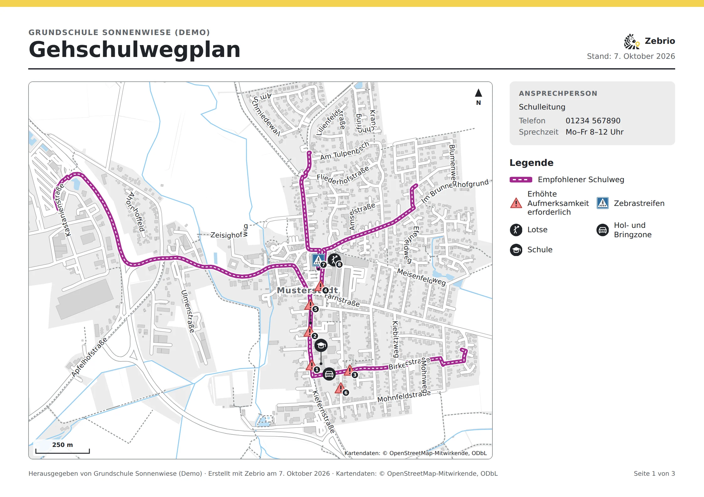
A walking or cycling route plan is a map of recommended routes, safe crossings and dangerous spots around the school. It is usually made by the municipality together with the school, the police and the traffic authority. In Baden-Württemberg, a decree of the state interior ministry requires the municipalities to draw up a walking route plan with the schools for every primary school.
Which streets the children actually use
Where parents see their child in danger
Where the municipality and the traffic authority can act
What your school route plan could look like
Four steps to the data
The school sets up the survey in about 10 minutes and prints a letter with a QR code for every child.
Parents draw their child's route to school on a map and mark dangerous and good spots, on a phone or a computer.
The school sees the results straight away: the most used routes, grouped problem spots, means of transport and the reasons for driving children.
The school passes the report and the GIS data to the municipality. They are the basis for the school route plan and the site inspection.
What the survey records
The route to school
Starting point (home or bus stop), means of transport and the route street by street.
Problem spots
Dangerous spots in fixed categories, such as no safe crossing, parked cars, places that are hard to see or places where children feel unsafe.
Good spots
What already works well: zebra crossings, traffic lights, crossing patrols or quiet paths.
Children driven to school
Why children are driven, where they get out and which way they would walk.
Children on the bus
At which stop children get off and which way they walk from there.
Parents' comments
Short notes and suggestions, which the school checks and approves for the report.
Why the parents' view matters
Parents know their child's way every day, in winter, in the dark and at rush hour. They know where their child has to wait, where it feels unsafe and why it is sometimes driven. With Zebrio this knowledge reaches the planning in an orderly way, instead of getting lost in single conversations and paper forms.
Parentsshow routes and spots
Schoolwrites a report
Municipality and traffic authorityreceive the report
School route planand improvements on site
Try it first
In the demo you play through a school route survey at the invented Sonnenwiese primary school in Musterstadt, from both sides. As a parent you draw a route to school and mark dangerous and good spots. As the school you open the analysis with the key sheet and see the answers of 60 sample families on the map, up to the finished report. So you know beforehand exactly what it means for the school and the parents. You get a personal access for 14 days on request by email. The demo is in German.
As a parent
Draw the route to school, mark dangerous and good spots, send it encrypted.
As the school
The analysis with the map, problem spots, means of transport and the reasons for driving children.
The report
Ready for the municipality and the traffic authority, as a web page, PDF and GIS data.
- From the survey to the planThe whole process: set up, ask the parents, analyse and draw the school route plan.
- The planning toolDraw a school route plan from the results, print it and pass it on.
- Survey guideA timetable and texts to copy for the newsletter, parents' evening and reminder.
- For municipalities and traffic authoritiesReport, maps and GIS data for site inspections and planning.
Zebrio at your school too?
Schools, parents' councils and municipalities that would like to run a school route survey can simply send us an email. We answer your questions and set up the survey for the school.